![]()
![]()
![]()
![]()
![]()
![]()


MY MAPS
Regions:
![]()
Browse the website:
Latest Acquisitions
A Brief History of Cartography
The Cartographers
Events on ancient maps
Accimo editions
Brochure MB
Contacts
Glossary
Sitemap
|
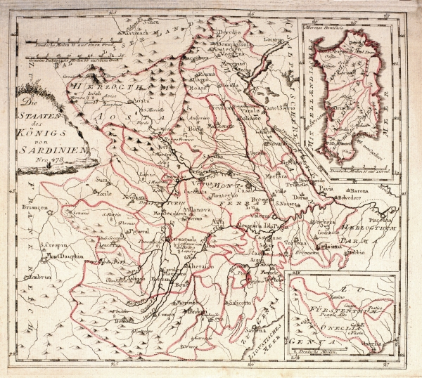
640-Die Staaten des Konigs von Sardinien Description: This map, measuring 22,5 x 25,1 cm and printed in 1789 in Vienna, was drawn by Franz Johann Joseph von Reilly. It shows the Sardinian Kingdom's territory with the island in a square on the top right. At the bottom appears the Dukedom of Oneglia Genua. The title is on the left, the graphic scales are at the top. Autor: Franz Johann Joseph Von Reilly Place: Vienna. PREZZO € 26.00 Year: 1789 Quality document:
See online :
Go to verification |