![]()
![]()
![]()
![]()
![]()
![]()


MY MAPS
Regions:
![]()
Browse the website:
Latest Acquisitions
A Brief History of Cartography
The Cartographers
Events on ancient maps
Accimo editions
Brochure MB
Contacts
Glossary
Sitemap
5 results
|
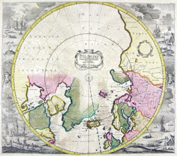
34-Poli Artici .
The map belongs to the Atlas de la Navigation et du Commerce qui se fait dans toutes les Parties du Monde, published in 1715 in Amsterdam.
taken from a fine engraving and decorated with a lot of drawings. Dimensions: 48,6 x 43 cm Author: Louis Renard
Amsterdam,1715 |
|
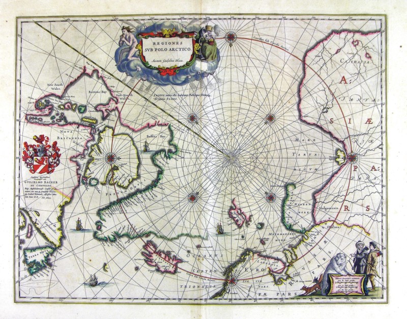
58-Regiones Sub Polo Artico .
The map belongs to the Geographia, quae est cosmographiae Blauianae pars prima, qua orbisterrae tabulis ante oculus ponitus et descriptionibus illustratur, published in 1665 in Amsterdam. Dimensions: 53 x 48,5 cm. Author: Ioannis Blaeu
Amsterdam,1665 |
|
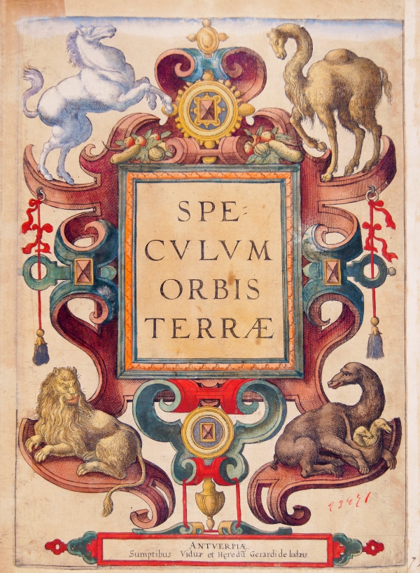
991-Speculum Orbis Terrae .
Author: Gerardus de Judaeis
Anversa,1593 |
|
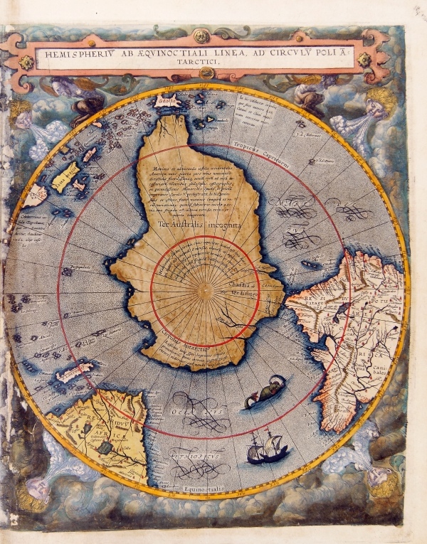
992-Hemisperium ab aequinoctiali linea, ad circulum poli antarctici. .
Hemisperium ab aequinoctiali linea, ad circulum poli antarctici. Antwerp 1593
Map of the Southern hemispere, Antwerp 1593. Color print from copper engraving (printer Arnold Coninx), 33 x 52 cm
Author: Gerardus de Judaeis
Anversa,1593 |
|
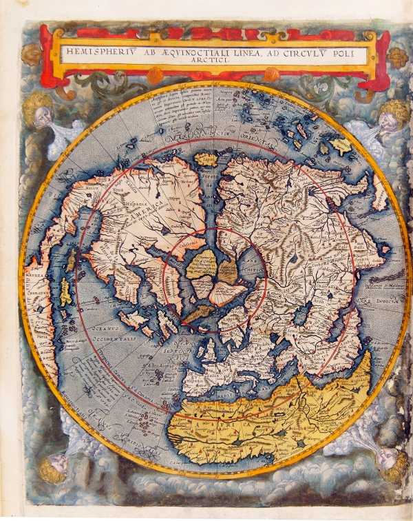
993-Hemisperium ab aequinoctiali linea, ad circulum poli arctici. Antwerp 1593 .
Hemisperium ab aequinoctiali linea, ad circulum poli arctici. Antwerp 1593
Map of the Northern hemispere, Antwerp 1593. Color print from copper engraving (printer Arnold Coninx), 33 x 52 cm
The map is an example of the imaginatory powers of early cartographers. Gerard de Jode has visualized the appearance of the Earth as if seen from orbit at a vantage point above the celestial pole.
Author: Gerardus de Judaeis
Anversa,1593 |