![]()
![]()
![]()
![]()
![]()
![]()


MY MAPS
Regions:
![]()
Browse the website:
Latest Acquisitions
A Brief History of Cartography
The Cartographers
Events on ancient maps
Accimo editions
Brochure MB
Contacts
Glossary
Sitemap
|
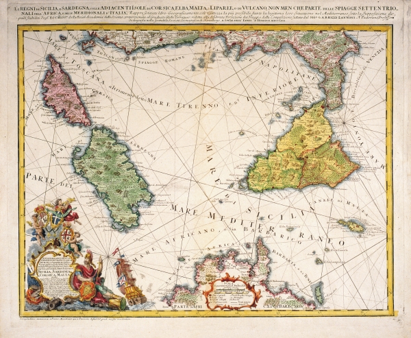
632-Li Regni di Sicilia e Sardegna Description: The map, measuring 56,6 x 43,4 cm and drawn by Giovanni Antonio Rizzi Zannoni, is taken from the Atlas Maior Scholasticus, printed by the heirs of Homann in 1762 in Nuremberg. It shows the Tyrrhenian Sea with the three most important Mediterranean islands, part of the Italian peninsula and the North of Tunisia. A splendid title picture appears on the bottom left; the graphic scales in Italian and Mediterranean miles are included in a beautiful picture in the centre-bottom. It is an important map introducing considerable improvements in the cartographic precisionof that period. Autor: Rizzi Zannoni Place: Norimberga Year: 1762 Quality document:
See online :
Go to verification |