![]()
![]()
![]()
![]()
![]()
![]()


MY MAPS
Regions:
![]()
Browse the website:
Latest Acquisitions
A Brief History of Cartography
The Cartographers
Events on ancient maps
Accimo editions
Brochure MB
Contacts
Glossary
Sitemap
|
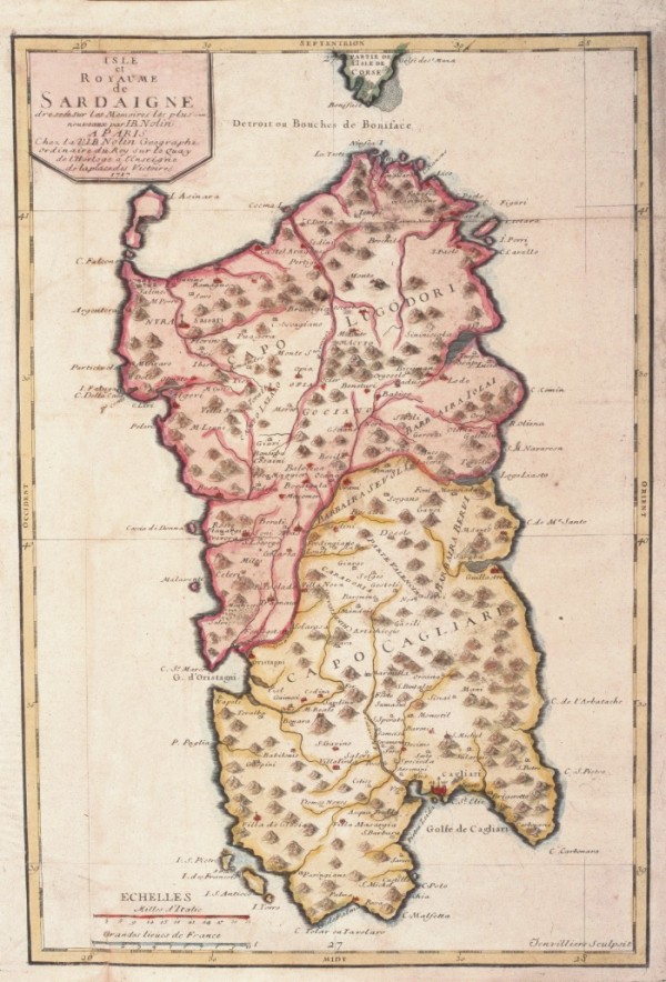
619-Isle et Royame de Sardaigne Description: Color map, derived from an engraving in copper alloys by Jean baptiste Nolin (1657-1708). L Charter is taken from opera Le Theatre du Mond dedié au Roi pleased the cartes générales et particulieres roiames et des Etats qui le composent avec plusieurs provinces, published since 1700 ... the Charter was also used in other Atlas Nolin (Nouvelle edition du Theatre de la Guerre en Italie ..) The card that offers both Northern and southern areas in different colours, is graduated in low margins, there are 2 scales graphics. The coasts are dashed blue, hydrography represents the main watercourses, whereas I see is a bunch of mole. Autor: Jean Baptiste Nolin Place: Parigi Year: 1717 Quality document:
See online :
Go to verification |