![]()
![]()
![]()
![]()
![]()
![]()


MY MAPS
Regions:
![]()
Browse the website:
Latest Acquisitions
A Brief History of Cartography
The Cartographers
Events on ancient maps
Accimo editions
Brochure MB
Contacts
Glossary
Sitemap
|
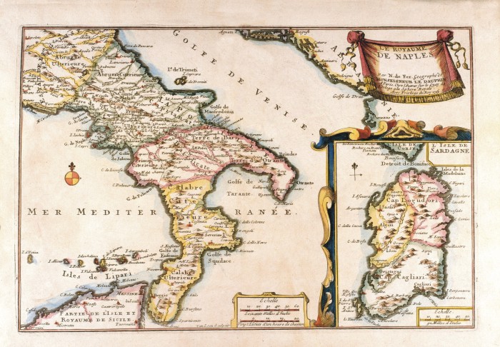
612-Le Royame de Naples Description: This map, measuring 22 x 32,7 cm and drawn by N. de Fer, Geographe de Monseigneur de Dauphin, is taken from the Atlas curieux ou le Monde représenté dans les cartes générales et particulières du ciel et de la terre (...),printed in 1705 in Paris. It is a beautiful coloured document. A festoon on the top right contains the title. The graphic scales Echelle Soixante Milles d'Italie and Vingt Lieues d’un heure de chemin are in a square at the bottom. The Sardinia Island with its own graphic scale appears separately on the right. Autor: Dauphin Place: Paris Year: 1705 Quality document:
See online :
Go to verification |