![]()
![]()
![]()
![]()
![]()
![]()


MY MAPS
Regions:
![]()
Browse the website:
Latest Acquisitions
A Brief History of Cartography
The Cartographers
Events on ancient maps
Accimo editions
Brochure MB
Contacts
Glossary
Sitemap
|
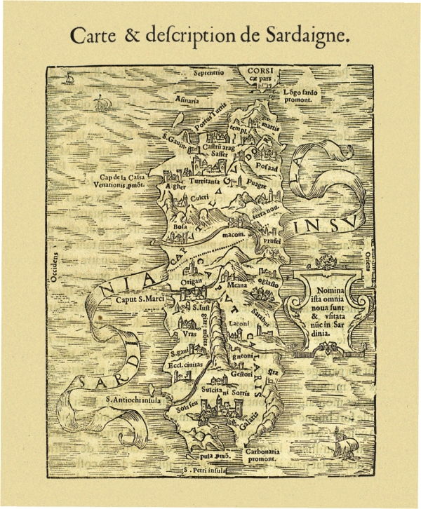
323-Carte & descripption de Sardaigne Description: The paper measure cm 15,5 x 7.6, and is located at p. 213 Atlas Discours Historial de antique et illustre citè de Nismes En la Gaule Narbonoise, Avec les portraits des plus antiques et insignes bastimens du lieu dit, reduits to leur vraye mesure et proportion, ensemble de antique et moderne Ville is Par Jean Poldo Of Albenas, in Lyon, par Guillome Roville. Avec privilege pour dix ans 1560. On the last page however appears as date printed on 15th April 1564. This document map feature of Sardinia shows no significant new elements with respect to knowledge of the time and again, with a few insignificant variations, the paper made by Sigismondo Arquer and published by Munster in Latin language edition of his Atlas of 1550. Autor: Antoine Du Pinet De Norot Place: Year: 1560 Quality document:
See online :
Go to verification |

See the printed version: Click here