![]()
![]()
![]()
![]()
![]()
![]()


MY MAPS
Regions:
![]()
Browse the website:
Latest Acquisitions
A Brief History of Cartography
The Cartographers
Events on ancient maps
Accimo editions
Brochure MB
Contacts
Glossary
Sitemap
|
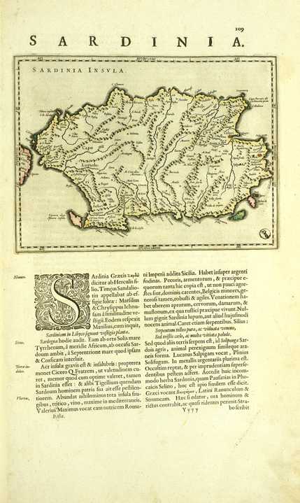
302-Sardinia Description: The map measures 19,2 x 14,6 cm and belongs to the latin edition of G. and I. Blaeu's atlas Theatrum Orbis Tertrarum sive Atlas Novus, part III, printed in 1640 in Amsterdam. Considering the long side of the island, Sardinia is on a scale of 1:1 525 000 and exposed in horizontally position, with the North on the left. The coast profil is well delineated, the most important promontories are marked and the gulf of Cagliari is correctly oriented. Autor: Gulielmus e Ioannis Blaeu Place: Amsterdam Year: 1640 Quality document:
See online :
Go to verification |