![]()
![]()
![]()
![]()
![]()
![]()


MY MAPS
Regions:
![]()
Browse the website:
Latest Acquisitions
A Brief History of Cartography
The Cartographers
Events on ancient maps
Accimo editions
Brochure MB
Contacts
Glossary
Sitemap
|
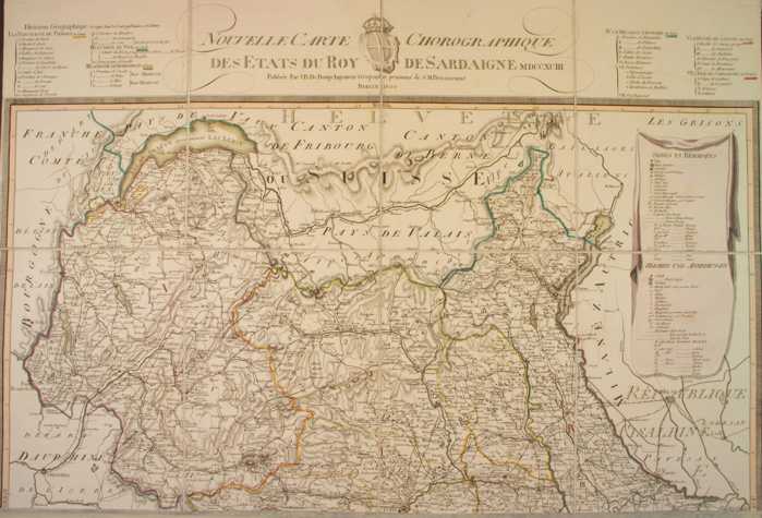
226-New chorographic map of the Sardinian's Empire States Description: The map, printed in 1793, measures 74 x 69 cm and is on scale 1:500 000. It exposes Savoy, the Aosta Valley and a sector of the Piedmont. Autor: J. B. Bouge Place: Berlino Year: 1793 Quality document:
See online :
Go to verification |